 Skip to content


Both GNSS and GPS share the same purpose: using satellite signals to determine your precise location on Earth. They rely on trilateration, atomic clocks, and line-of-sight reception to deliver real-time positioning data. This shared foundation often causes confusion, hence the frequent GNSS vs GPS debates among users. The real question isn't which works, but how GPS and GNSS coverage and accuracy differ in practice. To help you out, let's break down what each term means and which one suits your needs best.
GNSS vs GPS: Key Difference Comparison
The core difference between GNSS and GPS is simple: GPS is one system; GNSS is all systems. GPS is the U.S.-owned satellite constellation. GNSS is the umbrella term for every global satellite navigation system in operation, including GPS, Russia's GLONASS, Europe's Galileo, China's BeiDou, and more. Think of it this way: GPS is a single brand; GNSS is the entire product category.
| GPS | GNSS | |
|---|---|---|
| Definition | A U.S.-operated satellite navigation system | The collective term for all global satellite navigation systems |
| Satellites | 31 satellites (all from the U.S.) | 100+ satellites (from GPS, GLONASS, Galileo, BeiDou, etc.) |
| Coverage | Global | Global |
| Accuracy | Good | Better (more satellites = improved geometry) |
| Reliability | Dependent on one system | Higher — if one system fails, others compensate |
| Common Uses | Everyday navigation, car GPS, basic phone location | Surveying, aviation, farming, autonomous driving, and more |
What Is GPS?
GPS stands for Global Positioning System. It is a space‑based radio‑navigation system owned by the U.S. government and operated by the U.S. Space Force. Simply put, it's a network of satellites that helps you figure out exactly where you are on Earth anytime, anywhere, in any weather.
A Quick History
GPS wasn't built for finding the nearest coffee shop. It started as a military project. In 1973, the U.S. Department of Defense began developing a navigation system called NAVSTAR GPS (Navigation Satellite Timing and Ranging Global Positioning System). The goal was to give U.S. forces a reliable way to pinpoint positions anywhere in the world.
The system reached Initial Operational Capability in December 1993, and on April 27, 1995, it was declared fully operational with a full constellation of 24 satellites. A pivotal moment came in 1983, when President Reagan opened GPS for civilian use after a Korean airliner was shot down for straying into Soviet airspace. Today, that same military‑born technology is freely available to everyone on the planet.
How GPS Works
GPS has three main parts:
- Satellites (Space Segment) — Currently, about 31 GPS satellites orbit Earth at roughly 20,200 km (12,550 miles) altitude. Each carries an atomic clock and continuously broadcasts a signal containing its position and the exact time.
- Ground Stations (Control Segment) — A network of stations on the ground tracks the satellites, monitors their health, and sends them correction data.
- Receivers (User Segment) — This is the GPS chip in your phone, car, or smartwatch. It picks up satellite signals and calculates your location.

The magic happens through a process called trilateration. Here's the simplified version:
- Your GPS receiver measures how long it took for a signal to travel from a satellite to you.
- It multiplies that time by the speed of light to figure out your distance from that satellite.
- With one satellite, you could be anywhere on a sphere around it.
- With two, you narrow it down to a circle.
- With three, you get two possible points.
- With four or more satellites, the receiver can pinpoint your exact latitude, longitude, and altitude—and even correct for tiny clock errors in the receiver itself.
Think of it like this: if you know you're 10 miles from New York, 8 miles from Boston, and 6 miles from Philadelphia, there's only one spot on the map where all three circles meet. GPS does the same thing, but with spheres in space.
What Is GPS Used For?
GPS is everywhere. It guides cars, planes, and ships. Farmers use it for precision agriculture. Surveyors and scientists rely on it for mapping and measuring tectonic plate movements. And of course, it is used in phones and smartwatches to help hikers, runners, and more outdoor users find their way. Basic civilian GPS can locate you within about 10 meters (33 feet) — good enough for most daily needs. High‑precision setups can get within a fraction of an inch.
What Is GNSS?
GNSS stands for Global Navigation Satellite System. It is the standard generic term for any satellite constellation that provides autonomous positioning with global coverage. As of late 2025, six satellite systems are officially part of the GNSS family: four global systems and two regional systems that augment global coverage:
| System | Full Name | Operational Satellites | Country / Region |
|---|---|---|---|
| GPS | Global Positioning System | 31 | United States |
| GLONASS | Global'naya Navigatsionnaya Sputnikovaya Sistema | 24 | Russia |
| Galileo | Galileo Navigation Satellite System | 25 | European Union |
| BeiDou (BDS) | BeiDou Navigation Satellite System | 50 | China |
| QZSS | Quasi-Zenith Satellite System | 5 | Japan |
| NavIC | Navigation with Indian Constellation | 7 | India |
How GNSS Works
Like GPS, a GNSS system is built on three main segments:
- Space Segment — The satellites themselves. Each carries precise atomic clocks and continuously broadcasts signals containing its position and the exact time.
- Control Segment — A global network of ground stations that tracks the satellites, monitors their health, and sends them correction data.
- User Segment — The receivers — your phone, smartwatch, or car navigation system — that pick up satellite signals and calculate your location.
The positioning method is called trilateration. Your receiver measures how long it took for signals to travel from at least four satellites to you. It multiplies that time by the speed of light to calculate your distance from each satellite. With four or more distance measurements, the receiver can pinpoint your exact latitude, longitude, and altitude — all in a fraction of a second.

What Is GNSS Used For?
GNSS is everywhere. Not just in phones and cars, but in aviation, maritime navigation, precision agriculture, surveying, autonomous vehicles, disaster response, and scientific research. It provides Positioning, Navigation, and Timing (PNT) services that modern infrastructure relies on. Cell towers use GNSS for precise time synchronization. Power grids depend on it. Even financial transactions use GNSS timestamps.
In smart devices, you'll often see variations, like A‑GNSS (Assisted GNSS), which uses cellular networks to speed up satellite acquisition, or Multi‑GNSS, which refers to receivers that can track multiple constellations at once for better accuracy and reliability. These are essentially GNSS with extra help or broader capabilities, but the core positioning technology remains the same.
GNSS vs GPS: Difference in How They're Used?
The difference between GPS and GNSS plays out in real-world applications every day. In practice, most devices don't use either system alone. They combine GNSS or GPS with complementary technologies to overcome signal blockage, atmospheric interference, and urban canyons. Below is a summary of how each system is applied across different scenarios, along with the technologies they're paired with and leading brands in each field.
| Application | Typical Setup | Key Technologies | Example Brands |
|---|---|---|---|
| Surveying & Construction | High-precision GNSS + correction services | RTK, PPP, network correction | Trimble, Topcon, Leica, ComNav |
| Precision Agriculture | GNSS-guided tractors + base stations | RTK, autosteer | ComNav, CHCNAV, Trimble, Topcon |
| Aviation | Multi-constellation GNSS + INS | SBAS, inertial sensors | Garmin Aviation, Honeywell |
| Maritime | GNSS + satellite communications | INS, sonar, satellite comms | Furuno, Garmin Marine |
| Autonomous Vehicles | GNSS + cameras + LiDAR + IMU | RTK, sensor fusion, computer vision | Trimble, Hexagon, Bosch |
| Hiking & Running | Multi-GNSS smartwatches | Dual-band, multi-constellation | Garmin, COROS, Apple, Samsung, Mibro |
| Everyday Navigation | GPS or basic GNSS | A-GNSS, cellular networks | Garmin, TomTom, smartphone OEMs |
Notes on Abbreviations
- RTK (Real-Time Kinematic): Uses correction data to provide centimeter-level positioning accuracy.
- PPP (Precise Point Positioning): Uses precise satellite data to improve positioning without a local base station.
- INS (Inertial Navigation System): Uses motion sensors to estimate position and movement when satellite signals are weak or unavailable.
- SBAS (Satellite-Based Augmentation System): Uses correction signals from satellites to improve GNSS accuracy and reliability.
- IMU (Inertial Measurement Unit): Combines motion sensors such as accelerometers and gyroscopes to track movement.
- LiDAR (Light Detection and Ranging): Uses laser pulses to measure distances and create detailed 3D maps.
- A-GNSS (Assisted GNSS): Uses network data to help devices acquire satellite signals faster.
The Marketing Hype: What GNSS and GPS Might Mean
Here's where things can get confusing. When you shop for a smartwatch or fitness tracker, you might see terms like "GPS," "GNSS," "multi‑GNSS," "dual‑band," and "multi‑constellation" used almost interchangeably. Many brands still use "GPS" as a catch‑all term simply because consumers recognize it even when the device's chip may actually support GNSS.
In many cases, a smartwatch marketed as having "GPS" could very well be GNSS‑enabled underneath. It might access multiple satellite systems (GPS, GLONASS, Galileo, BeiDou, etc.) without explicitly saying so. The real differentiator isn't always GPS vs GNSS — it could be dual‑band vs single‑band, or multi‑constellation vs single‑constellation.
- Multi‑constellation means the watch might see satellites from multiple systems, which can improve reliability and give you a faster fix.
- Dual‑band means the watch potentially uses two frequencies (L1 and L5). The L5 band is less affected by atmospheric distortion and signal reflections, so it can provide better accuracy in cities, forests, and mountains.
So when you see "advanced GPS" or "premium GPS" on a smartwatch box, that could simply be marketing shorthand for what is actually multi‑GNSS with dual‑band support. The core technology is often GNSS, but "GPS" remains the term consumers already know and trust.
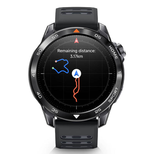
Which Is More Accurate for Smartwatches?
For smartwatches, GNSS is clearly more accurate than GPS alone — especially when combined with dual‑band support and multi‑constellation tracking. Standard GPS‑only positioning on a smartwatch typically delivers accuracy within 3 to 10 meters in open‑sky conditions. A GNSS‑enabled watch that taps into multiple constellations (GPS + GLONASS + Galileo + BeiDou) can improve that to 1 to 3 meters under similar conditions. In challenging environments like dense forests or urban canyons, the gap widens even further.
Here's why GNSS wins on accuracy for smartwatches:
More Satellites, Better Geometry.
A GPS‑only watch sees roughly 31 U.S. satellites. A multi‑GNSS watch can see satellites from GPS, Galileo, GLONASS, and BeiDou combined — often 20 or more at any given moment. More satellites mean better satellite geometry (satellites spread more widely across the sky), which directly improves positioning precision. Studies show that multi‑constellation GNSS can improve positioning accuracy by up to 63% compared to GPS‑only solutions.
Dual‑Band Makes It Even Better.
The accuracy of GPS on a single‑band (L1 only) watch can degrade significantly when signals bounce off buildings or trees — a problem called multipath error. Modern high‑end smartwatches use dual‑band GNSS (L1 + L5 frequencies). The L5 band is less affected by atmospheric distortion and signal reflections. According to Qualcomm, a dual‑band watch can be 50% more accurate than a standard GPS‑only watch in challenging areas.
The Hardware Reality.
Smartwatches have inherent limitations. Their small internal antennas and power constraints mean they can't match the accuracy of GNSS achieved by dedicated surveying equipment or even smartphones. However, recent research has demonstrated that with advanced algorithms, smartwatches can achieve centimeter‑level precision under stationary conditions by combining signals from multiple GNSS systems.
Do You Need GNSS or GPS in a Smartwatch?
GNSS is more accurate than GPS, but that extra precision comes at a cost. Smartwatches with multi‑GNSS and dual‑band support are typically more expensive, consume more battery, and require more powerful chips. The question isn't "which is better" in absolute terms — it's "which fits your needs and budget?"
Everyday Users (Walking, Commuting, Indoor Fitness)
Best choice: GPS‑only or basic GNSS
If you just want to track your daily steps, log an occasional walk, or check your route home, a standard GPS‑only watch is perfectly fine. Most budget and mid‑range fitness trackers use single‑constellation GPS — and that's okay. A 3–10 meter accuracy margin won't matter for a casual stroll around the neighborhood. You'll save money and get better battery life.
Runners & Cyclists (City Streets, Parks, Open Roads)
Best choice: Multi‑GNSS (single‑band)
If you're tracking pace, distance, and route consistency, you'll benefit from multi‑constellation GNSS — even without dual‑band. A watch that taps into GPS + GLONASS + Galileo gives you faster fixes and better tracking around buildings and trees. Most dedicated running watches from Garmin (Forerunner series), COROS, and Polar use this approach. Accuracy within 2–5 meters is more than enough for training purposes.
Outdoor Adventurers (Trail Running, Hiking, Backcountry)
Best choice: Multi‑GNSS + Dual‑Band
This is where the GNSS vs GPS decision really matters. In forests, canyons, and mountainous terrain, GPS‑only watches often lose signal or wander off course. You need a watch that can see as many GNSS satellite system options as possible — and use the L5 band to cut through tree cover and rock reflections.
Conclusion
The difference between GPS and GNSS comes down to scope: GPS is one U.S. system; GNSS is the entire family of global satellite constellations. GNSS offers better accuracy, reliability, and coverage, especially in challenging environments, but that extra performance costs more and drains the battery faster. In the GNSS vs GPS decision, there's no universal "best." For casual walks and gym workouts, GPS or basic GNSS is plenty. For serious running, city cycling, or backcountry adventures, invest in multi‑GNSS with dual‑band. Whether it's a smartwatch or any other device, always match the technology to your actual needs and your budget.

